Biodiversity disclosure is becoming part of corporate reporting — yet measuring nature impact remains fragmented and complex.
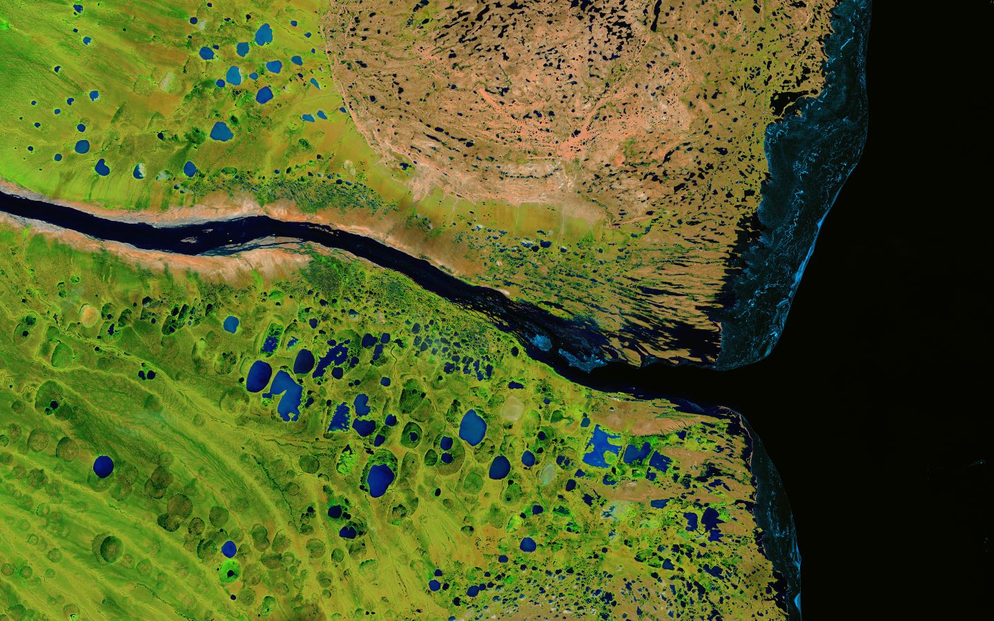
CC BY Landsat365 and USGS/NASA
Biodiversity intelligence platform built for the next seven generations (and more).
CC BY Landsat365 and USGS/NASA
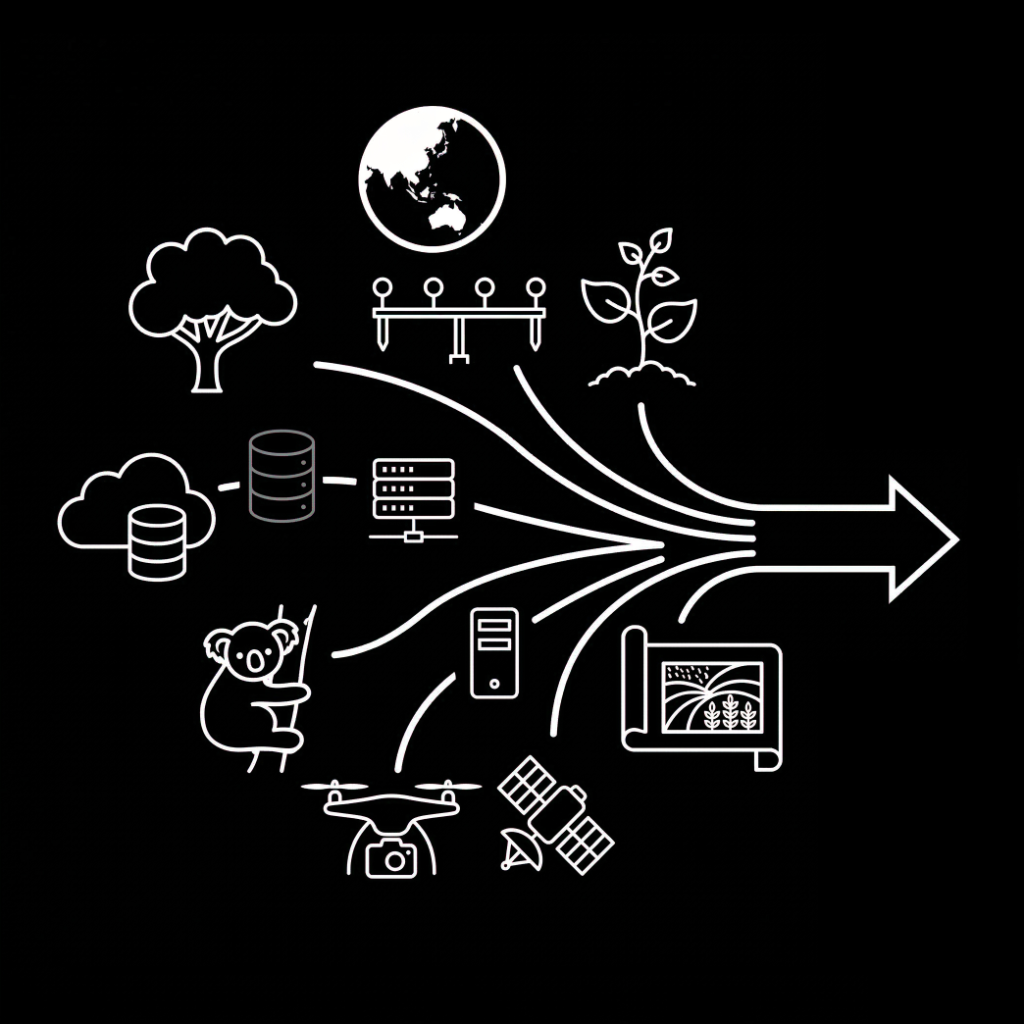
Teams must collect biodiversity datasets, run assessments and compile reports across multiple data sources, consultants and disconnected tools.
Fragmented data silos (Satellite, LiDAR, Field Surveys) create a 3-month 'analysis lag' that stalls project approvals.
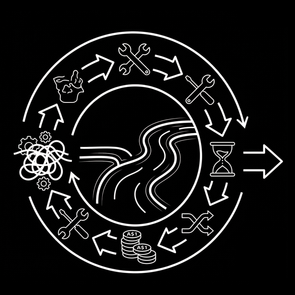
Currently requires specialised ecological consultants and manual spatial engineering for every asset.
Takes months to move from raw coordinates to a verified biodiversity health score.
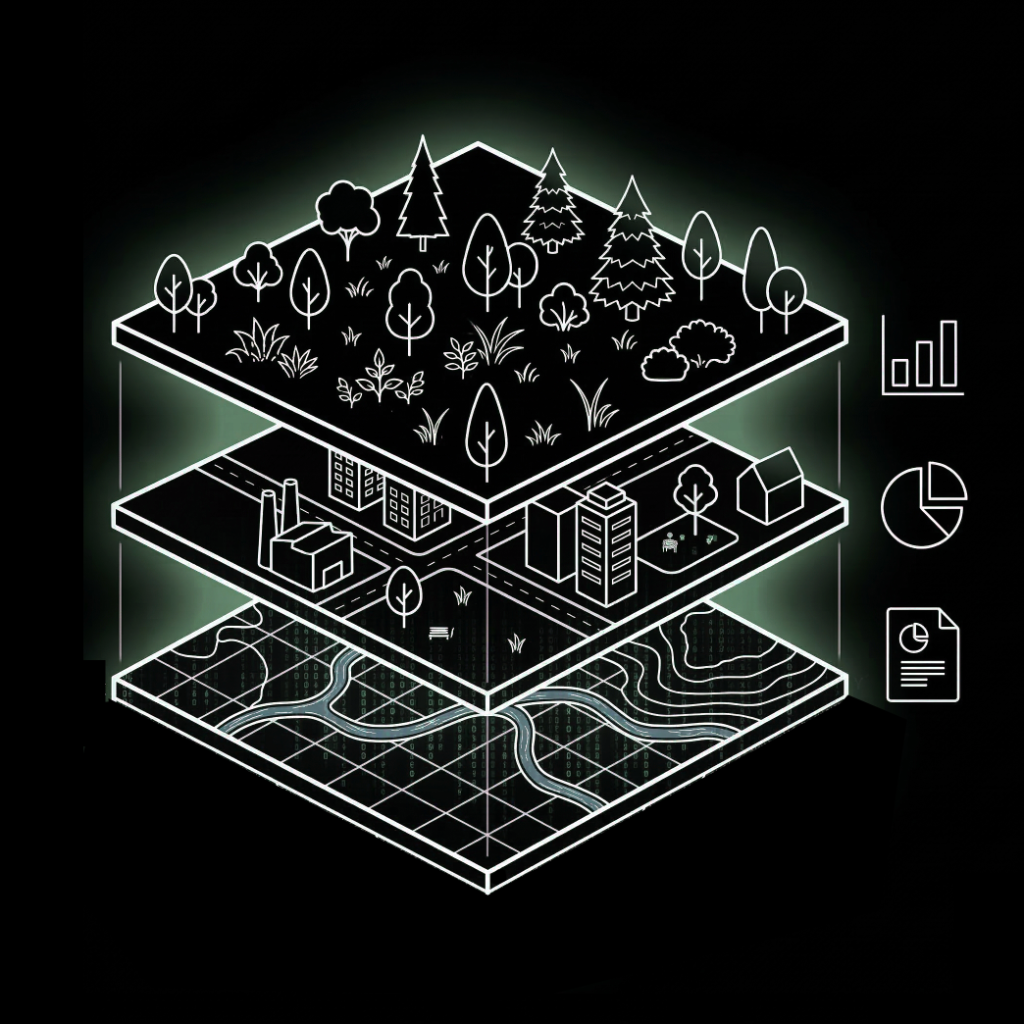
Enables organisations to manage biodiversity data, assess and measure nature impact and generate compliant disclosures in one integrated system.

CC BY Landsat365 and USGS/NASA
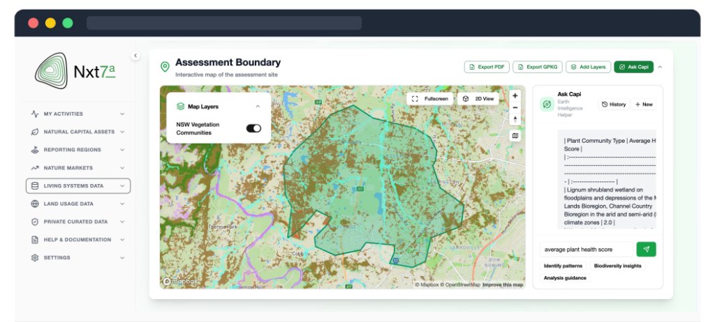
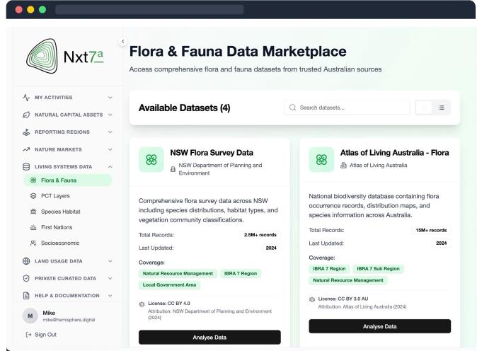
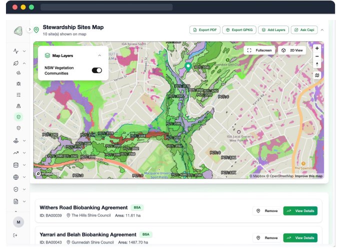
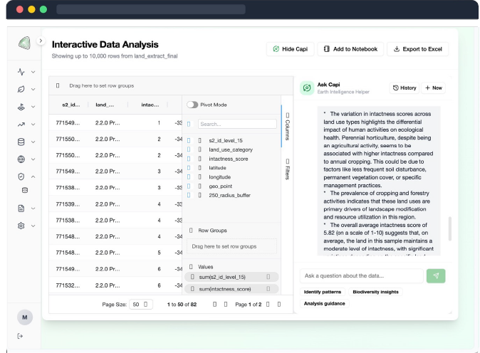
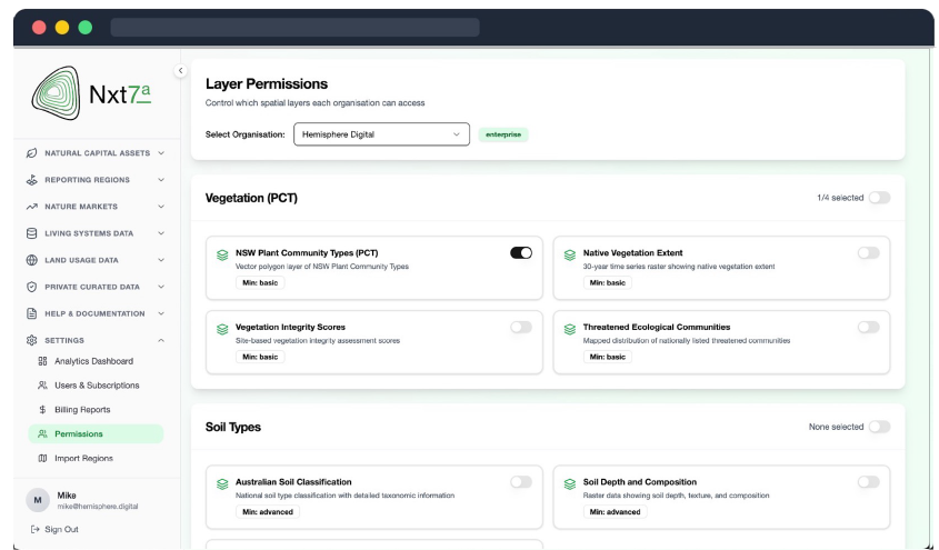
A user-friendly interface allows organisations to manage biodiversity datasets, measure inventories and run advanced analytics through an LLM-powered assistant.
Customers pay for platform access via subscription, with additional usage-based pricing for biodiversity data based on volume or hectare.
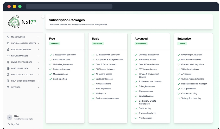
Monthly or annual platform licenses, from SME to enterprise.
Data consumption model, pay for what you use – per seat/area.
"I can't imagine anything more important than air, water, soil, energy and biodiversity. These are the things that keep us alive."
David Takayoshi Suzuki · CC OBC FRSC
Join other environmental services professionals looking for 10x faster workflows for reporting on nature.